
 View larger

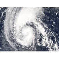
Analyzing Hurricanes Using Web and Desktop GIS
New activity
Patrons use a database from NOAA to map hurricanes from different decades, and then build their own map using data from National Atlas to learn about how hurricanes form
Open Activity
- Write a review
Related Programming Resources
| Add a Tech Twist | Required: Computers with internet access to examine hurricane data from NOAA |
| Collection | This activity works best if every participant has access to their own computer or tablet for viewing online hurricane data |
| Related Links |
American Geosciences Institute
Historical Hurricane Tracks National Oceanic and Atmospheric Administration |
| Originating Source | Earth Science Week |
| Related Books [Suggest a book] |
Hurricanes by Kay Manolis
Hurricanes! By Gail Gibbons Hurricanes by Nathan Olson |